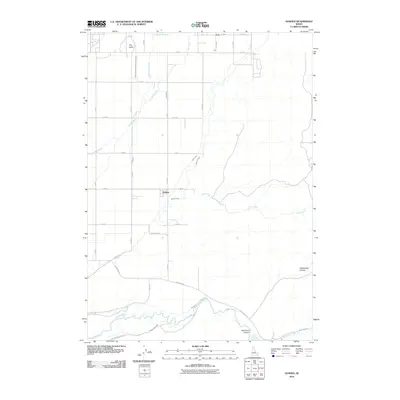
2010 Map of Goshen
USGS Topo · Published 2010About this map
The Goshen settlement area is defined by its complex agricultural water management system, where the high desert terrain meets the fertility of the Blackfoot River basin. Extensive irrigation infrastructure, including the Idaho Canal, Highline Canal, and Just Canal, demonstrates the engineering required to support ranching and farming in this part of Bingham County. The landscape is punctuated by distinct geological landmarks like The Butte in the northwest and the carved depths of Wolverine Canyon and Rattlesnake Canyon to the southeast. Local transport follows a strict grid pattern with routes like Wolverine Rd and Reid Rd connecting scattered homesteads and the small community of Cox. The presence of the East Branch Snake River Valley Canal and Little Indian Ditch further illustrates the dense network of water rights and distribution that has shaped the local economy since the early twentieth century.
Find a feature on this map
36 named features on this map. Tap any name to fly to it.
Don’t see what you’re looking for? This feature index may not catch every label — zoom into the map to look around manually.
Map Details
Editions of this 2010 Goshen Map
This is the sole edition of this map. No revisions or reprints were ever made.
Other maps of this area

1918 · Paradise Valley
USGS Topo · 1:62,500

1924 · Ammon
USGS Topo · 1:62,500

1948 · Woodville
USGS Topo · 1:24,000

1948 · Idaho Falls South
USGS Topo · 1:24,000

1950 · Woodville
USGS Topo · 1:24,000

1950 · Idaho Falls South
USGS Topo · 1:24,000

1950 · Goshen
USGS Topo · 1:24,000

1951 · Higham Peak
USGS Topo · 1:24,000

1952 · Goshen
USGS Topo · 1:24,000

1955 · Lincoln Creek
USGS Topo · 1:24,000