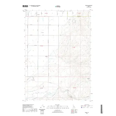
2020 Map of Goshen
USGS Topo · Published 2020About this map
Goshen and the settlement of Cox anchor this landscape in southeastern Idaho, where the irrigation-driven economy of Bingham County meets the rising terrain of the eastern hills. The complex network of waterways, including the Snake-R-Valley Canal, Idaho Canal, and Highline Canal, illustrates the intensive management of water essential for agriculture on the Presto Bench. These man-made ditches work in tandem with natural features like the Blackfoot River to transform the arid sagebrush plains into productive farmland. To the east, the topography shifts abruptly at the Sand Hills, giving way to the deeply incised drainage systems of Wolverine Canyon and Rattlesnake Canyon. This 2020 survey also captures the grid of rural roads, such as Sugar Factory Rd and Jameston Rd, which link scattered farmsteads to the historic centers of trade and transportation in this high desert region.
Find a feature on this map
63 named features on this map. Tap any name to fly to it.
Don’t see what you’re looking for? This feature index may not catch every label — zoom into the map to look around manually.
Map Details
Editions of this 2020 Goshen Map
This is the sole edition of this map. No revisions or reprints were ever made.
Other maps of this area

1918 · Paradise Valley
USGS Topo · 1:62,500

1924 · Ammon
USGS Topo · 1:62,500

1948 · Woodville
USGS Topo · 1:24,000

1948 · Idaho Falls South
USGS Topo · 1:24,000

1950 · Woodville
USGS Topo · 1:24,000

1950 · Idaho Falls South
USGS Topo · 1:24,000

1950 · Goshen
USGS Topo · 1:24,000

1951 · Higham Peak
USGS Topo · 1:24,000

1952 · Goshen
USGS Topo · 1:24,000

1955 · Lincoln Creek
USGS Topo · 1:24,000