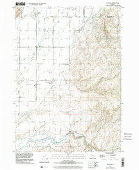
1998 Map of Goshen
USGS Topo · Published 2002About this map
Agricultural development and complex water management characterize this landscape south of Shelley in the late 1990s. The terrain is defined by the transition from the irrigated plains of the Snake River valley to the rising elevations of the Sand Hills and The Butte. A network of man-made waterways, including the Idaho Canal and the Little Indian Ditch, illustrates the region's reliance on diverted water for farming near settlements like Goshen.
Find a feature on this map
24 named features on this map. Tap any name to fly to it.
Don’t see what you’re looking for? This feature index may not catch every label — zoom into the map to look around manually.
Map Details
Editions of this 1998 Goshen Map
This is the sole edition of this map. No revisions or reprints were ever made.
Other maps of this area

1918 · Paradise Valley
USGS Topo · 1:62,500

1924 · Ammon
USGS Topo · 1:62,500

1948 · Woodville
USGS Topo · 1:24,000

1948 · Idaho Falls South
USGS Topo · 1:24,000

1950 · Woodville
USGS Topo · 1:24,000

1950 · Idaho Falls South
USGS Topo · 1:24,000

1950 · Goshen
USGS Topo · 1:24,000

1951 · Higham Peak
USGS Topo · 1:24,000

1952 · Goshen
USGS Topo · 1:24,000

1955 · Lincoln Creek
USGS Topo · 1:24,000