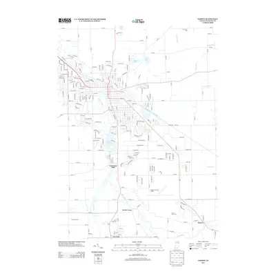
2013 Map of Goshen
USGS Topo · Published 2013About this map
The Elkhart River corridor south of Goshen defines this Indiana landscape, tracing a path through several distinct rural settlements. The river's influence on the local geography is evident at the Goshen Dam Pond and downriver toward Waterford Mills. Further south, the map documents the smaller communities of Bainter Town and New Paris, alongside the eastern settlement of Benton. This 2013 survey illustrates the modern layout of Elkhart County, where traditional agricultural operations like the L and D Dairy Farm and Prairie Dairy Farms sit adjacent to the growing aviation infrastructure of the Goshen Municipal Airport. The mapping of numerous drainage ditches, including Horn Ditch and Boyer Ditch, highlights the managed water systems critical to this region's fertile farmland.
Find a feature on this map
47 named features on this map. Tap any name to fly to it.
Don’t see what you’re looking for? This feature index may not catch every label — zoom into the map to look around manually.
Map Details
Editions of this 2013 Goshen Map
This is the sole edition of this map. No revisions or reprints were ever made.
Other maps of this area

1951 · Milford
USGS Topo · 1:24,000

1951 · Wawasee
USGS Topo · 1:24,000

1953 · Fort Wayne
USGS Topo · 1:250,000

1956 · Fort Wayne
USGS Topo · 1:250,000

1958 · Nappanee East
USGS Topo · 1:24,000

1959 · Millersburg
USGS Topo · 1:24,000

1959 · Goshen
USGS Topo · 1:24,000

1960 · Foraker
USGS Topo · 1:24,000
1961 · Lake Wawasee
USGS Topo · 1:24,000
1961 · Bristol
USGS Topo · 1:24,000