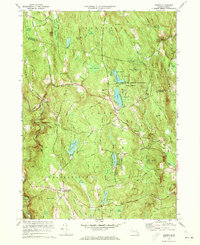
1972 Map of Goshen
USGS Topo · Published 1973About this map
The town of Goshen serves as the focal point of this 1970s topographical record, situated at the intersection of Chesterfield Road and South Main St. The landscape is defined by the Highland Lakes, which include Upper Highland and Lower Highland, surrounded by the extensive Daughters of the American Revolution State Forest. This area was a hub for recreational and social gatherings, as evidenced by the presence of Camp Holy Cross, Camp Howe, and various campgrounds near the water.
Find a feature on this map
117 named features on this map. Tap any name to fly to it.
Don’t see what you’re looking for? This feature index may not catch every label — zoom into the map to look around manually.
Map Details
Editions of this 1972 Goshen Map
4 editions found
Other maps of this area

1885 · Northampton
USGS Topo · 1:62,500

1886 · Hawley
USGS Topo · 1:62,500

1886 · Chesterfield
USGS Topo · 1:62,500

1886 · Northampton
USGS Topo · 1:62,500

1888 · Chesterfield
USGS Topo · 1:62,500

1890 · Hawley
USGS Topo · 1:62,500

1890 · Greenfield
USGS Topo · 1:62,500

1891 · Northampton
USGS Topo · 1:62,500

1893 · Northampton
USGS Topo · 1:62,500

1893 · Chesterfield
USGS Topo · 1:62,500