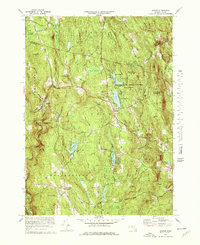
1972 Map of Goshen
USGS Topo · Published 1978About this map
Goshen and the surrounding Hill Towns of the Pioneer Valley are documented here during the early 1970s, showcasing a landscape of dense woodlands and high ridges. The map highlights the Daughters of the American Revolution State Forest and its significant water features, including Upper Highland and Lower Highland. Local history is anchored by early infrastructure such as the Center Sch and Goshen Cem near the town center, while the smaller settlement of Lithia sits at the junction of Stones Bk and the Swift River.
Find a feature on this map
89 named features on this map. Tap any name to fly to it.
Don’t see what you’re looking for? This feature index may not catch every label — zoom into the map to look around manually.
Map Details
Editions of this 1972 Goshen Map
4 editions found
Other maps of this area

1885 · Northampton
USGS Topo · 1:62,500

1886 · Hawley
USGS Topo · 1:62,500

1886 · Chesterfield
USGS Topo · 1:62,500

1886 · Northampton
USGS Topo · 1:62,500

1888 · Chesterfield
USGS Topo · 1:62,500

1890 · Hawley
USGS Topo · 1:62,500

1890 · Greenfield
USGS Topo · 1:62,500

1891 · Northampton
USGS Topo · 1:62,500

1893 · Northampton
USGS Topo · 1:62,500

1893 · Chesterfield
USGS Topo · 1:62,500