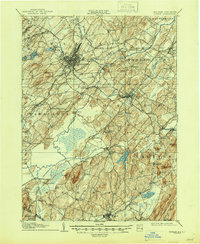
1946 Map of Goshen
USGS Topo · Published 1946About this map
Middletown and Goshen anchor this mid-century topographic survey of Orange County, where a complex network of steel rails defines the landscape. The Erie RR, New York Ontario and Western RR, and several other lines converge here, illustrating the region's importance as a transportation hub for the dairy and produce of the surrounding black soil region. The lowlands between Pellets Island and Big Island are marked by the Commissioners Ditch and Quaker Creek, drainage efforts that supported the local agriculture.
Find a feature on this map
97 named features on this map. Tap any name to fly to it.
Don’t see what you’re looking for? This feature index may not catch every label — zoom into the map to look around manually.
Map Details
Editions of this 1946 Goshen Map
This is the sole edition of this map. No revisions or reprints were ever made.
Other maps of this area

1888 · Franklin
USGS Topo · 1:62,500

1891 · Greenwood Lake
USGS Topo · 1:62,500

1891 · Ramapo
USGS Topo · 1:62,500

1893 · Greenwood Lake
USGS Topo · 1:62,500

1893 · Ramapo
USGS Topo · 1:62,500

1894 · Franklin
USGS Topo · 1:62,500

1897 · Franklin
USGS Topo · 1:62,500

1902 · Schunemunk
USGS Topo · 1:62,500

1903 · Newburg
USGS Topo · 1:62,500

1903 · Franklin Furnace
USGS Topo · 1:62,500