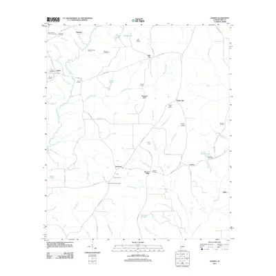
2011 Map of Goshen
USGS Topo · Published 2011About this map
The Conecuh River carves through this Pike County landscape, anchoring a network of rural settlements and family landmarks. In the west, the community of Goshen serves as a local hub, identifiable by the Goshen Post Office and Hillcrest Cemetery. The surrounding countryside is defined by its water-driven geography, with numerous small drainages like Smilies Mill Creek and Warrick Creek feeding into the main river valley. Small clusters of residents at Hallsville, Little Oak, and Henderson are connected by a web of county roads, reflecting a long-standing agricultural and timber-based economy.
Find a feature on this map
71 named features on this map. Tap any name to fly to it.
Don’t see what you’re looking for? This feature index may not catch every label — zoom into the map to look around manually.
Map Details
Editions of this 2011 Goshen Map
This is the sole edition of this map. No revisions or reprints were ever made.
Other maps of this area

1948 · Brundidge
USGS Topo · 1:62,500

1950 · Brundidge
USGS Topo · 1:62,500

1953 · Andalusia
USGS Topo · 1:250,000

1953 · Dothan
USGS Topo · 1:250,000

1954 · Dothan
USGS Topo · 1:250,000

1955 · Dothan
USGS Topo · 1:250,000

1957 · Andalusia
USGS Topo · 1:250,000

1960 · Victoria
USGS Topo · 1:24,000

1960 · Brundidge NW
USGS Topo · 1:24,000
1962 · Victoria
USGS Topo · 1:25,000