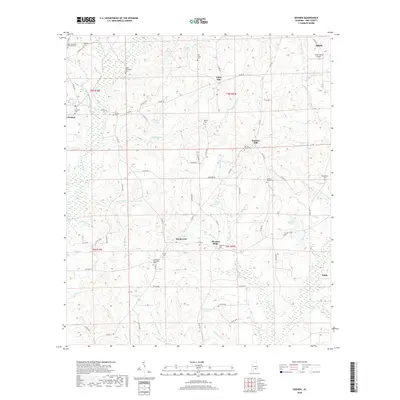
2018 Map of Goshen
USGS Topo · Published 2018About this map
The Conecu h River and its numerous tributaries, including Smilies Mill Cr and Warrick Cr, define the drainage patterns of this Pike County landscape. This 2018 survey details the rural character of the area around Goshen and Little Oak, where the terrain rises to Sanders Hill. For genealogists and local historians, the map is a dense record of family and community heritage, documenting numerous burial sites such as the Elam-Davidson Memorial Cem, Hillcrest Cem, and William Carter Cem. Small water bodies like Folmars Pond and Loflins Pond dot the countryside between county routes. In the northeastern corner, the outskirts of Troy are visible, including the Smart Road Airport, illustrating the modern transport infrastructure that connects these traditional farming communities to the larger region.
Find a feature on this map
83 named features on this map. Tap any name to fly to it.
Don’t see what you’re looking for? This feature index may not catch every label — zoom into the map to look around manually.
Map Details
Editions of this 2018 Goshen Map
This is the sole edition of this map. No revisions or reprints were ever made.
Other maps of this area

1948 · Brundidge
USGS Topo · 1:62,500

1950 · Brundidge
USGS Topo · 1:62,500

1953 · Andalusia
USGS Topo · 1:250,000

1953 · Dothan
USGS Topo · 1:250,000

1954 · Dothan
USGS Topo · 1:250,000

1955 · Dothan
USGS Topo · 1:250,000

1957 · Andalusia
USGS Topo · 1:250,000

1960 · Victoria
USGS Topo · 1:24,000

1960 · Brundidge NW
USGS Topo · 1:24,000
1962 · Victoria
USGS Topo · 1:25,000