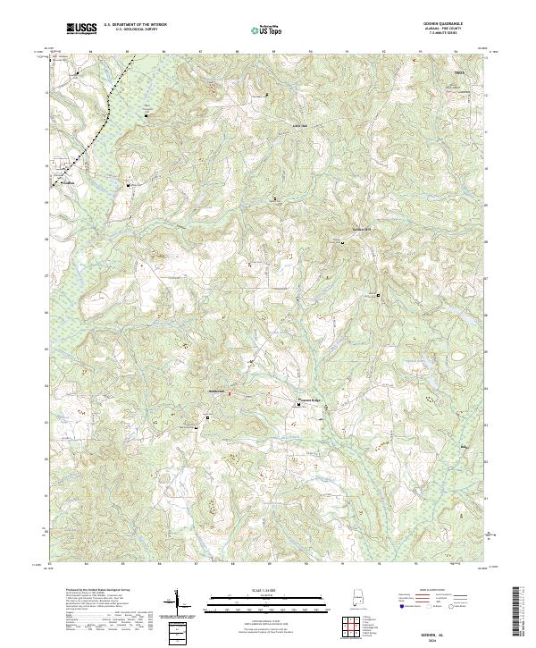
2024 Map of Goshen
USGS Topo · Published 2024About this map
The Conecuh River valley in Pike County defines this rural landscape, where established family cemeteries like the Old Salem Cem and Spillars Cem document generations of local residency. Small communities such as Henderson and Pleasant Ridge are connected by a network of county roads that navigate the complex drainage of Smilies Mill Creek and Warrick Creek. The terrain is punctuated by landmarks like Sanders Hill and small water bodies including Loflins Pond and Stewarts Pond, which reflect the area's agricultural and hydraulic character. To the northeast, the outskirts of Troy begin to appear near the Smart Road Airport, signaling the transition from the remote river bottomlands to the growing county seat. This detailed record of Pike County land use tracks the preservation of legacy family plots like the Henderson Memorial Cem alongside modern infrastructure like Goshen Rd.
Find a feature on this map
88 named features on this map. Tap any name to fly to it.
Don’t see what you’re looking for? This feature index may not catch every label — zoom into the map to look around manually.
Map Details
Editions of this 2024 Goshen Map
This is the sole edition of this map. No revisions or reprints were ever made.
Other maps of this area

1948 · Brundidge
USGS Topo · 1:62,500

1950 · Brundidge
USGS Topo · 1:62,500

1953 · Andalusia
USGS Topo · 1:250,000

1953 · Dothan
USGS Topo · 1:250,000

1954 · Dothan
USGS Topo · 1:250,000

1955 · Dothan
USGS Topo · 1:250,000

1957 · Andalusia
USGS Topo · 1:250,000

1960 · Victoria
USGS Topo · 1:24,000

1960 · Brundidge NW
USGS Topo · 1:24,000
1962 · Victoria
USGS Topo · 1:25,000