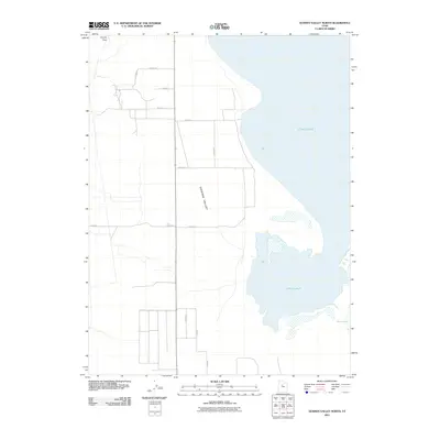
2011 Map of Goshen Valley North
USGS Topo · Published 2011About this map
Utah Lake dominates the eastern half of this landscape, its waters meeting the low-lying agricultural and desert terrain of the northern Goshen Valley. The western shoreline is marked by marshy inlets and the smaller White Lake, suggesting a dynamic riparian environment where the valley floor meets the water. In the north, Coyote Pass provides a natural corridor through the higher elevations, while a structured grid of rural roads, including W 8400 S St and S 12000 W, defines the settlement patterns south of the lake's primary basin. This survey documents the area's hydrology at a time when Pinyon Creek flowed from the southwest toward the lake. The intersection of desert mountain passes and significant freshwater resources illustrates the classic topographical constraints that have shaped development in this portion of Utah County.
Find a feature on this map
17 named features on this map. Tap any name to fly to it.
Don’t see what you’re looking for? This feature index may not catch every label — zoom into the map to look around manually.
Map Details
Editions of this 2011 Goshen Valley North Map
This is the sole edition of this map. No revisions or reprints were ever made.
Other maps of this area

1885 · Salt Lake
USGS Topo · 1:250,000

1885 · Manti
USGS Topo · 1:250,000

1885 · Sevier Desert
USGS Topo · 1:250,000

1885 · Tooele Valley
USGS Topo · 1:250,000

1895 · Manti
USGS Topo · 1:250,000

1947 · Fivemile Pass
USGS Topo · 1:62,500

1947 · Allens Ranch
USGS Topo · 1:24,000

1947 · Goshen Pass
USGS Topo · 1:24,000

1949 · Eureka
USGS Topo · 1:24,000

1949 · Allens Ranch
USGS Topo · 1:24,000