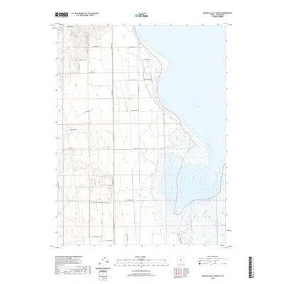
2020 Map of Goshen Valley North
USGS Topo · Published 2020About this map
Utah Lake dominates the eastern expanse of this Utah County landscape, where the waters meet the marshy western shoreline of Goshen Bay. The terrain transitions from the aquatic margins of the lake into the agricultural flats of Goshen Valley, defined by a precise grid of rural roads and irrigation patterns. This modern topographic survey by the U.S. Geological Survey shows the transition from the high ground at Coyote Pass in the northwest down toward the low-lying drainage of Pinyon Cr in the south. The infrastructure is characterized by long, straight thoroughfares such as S 12800 West St and the historic alignment of Old State Hwy 73, illustrating the organized land division typical of the region. This document serves as a detailed record of the contemporary shoreline and the water-management systems that sustain the valley floor.
Find a feature on this map
23 named features on this map. Tap any name to fly to it.
Don’t see what you’re looking for? This feature index may not catch every label — zoom into the map to look around manually.
Map Details
Editions of this 2020 Goshen Valley North Map
This is the sole edition of this map. No revisions or reprints were ever made.
Other maps of this area

1885 · Salt Lake
USGS Topo · 1:250,000

1885 · Manti
USGS Topo · 1:250,000

1885 · Sevier Desert
USGS Topo · 1:250,000

1885 · Tooele Valley
USGS Topo · 1:250,000

1895 · Manti
USGS Topo · 1:250,000

1947 · Fivemile Pass
USGS Topo · 1:62,500

1947 · Allens Ranch
USGS Topo · 1:24,000

1947 · Goshen Pass
USGS Topo · 1:24,000

1949 · Eureka
USGS Topo · 1:24,000

1949 · Allens Ranch
USGS Topo · 1:24,000