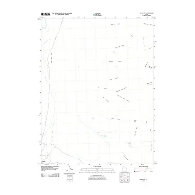
2011 Map of Goshute
USGS Topo · Published 2011About this map
Goshute sits at the southwestern edge of this landscape, where the Deep Creek Valley meets the rising elevations of the Deep Creek Range. The terrain is defined by a series of steep drainages including Eightmile Canyon, Kelly Canyon, and Durse Canyon, which funnel seasonal waters toward the valley floor. Transportation through this arid corridor follows established routes like Ibapah Rd and the aptly named Old Store Rd, tracing the historical paths between remote settlements and grazing lands. Water sources are critical markers in this high-desert environment, with Skinner Springs, Cold Spring, and Rocky Spring providing essential points of relief. To the east, the topography reaches its peak at Bald Mountain, overlooking complex geological features like The Delle and the riparian corridor of Birch Creek near The Meadows.
Find a feature on this map
35 named features on this map. Tap any name to fly to it.
Don’t see what you’re looking for? This feature index may not catch every label — zoom into the map to look around manually.
Map Details
Editions of this 2011 Goshute Map
This is the sole edition of this map. No revisions or reprints were ever made.
Other maps of this area

1908 · Fish Springs
USGS Topo · 1:250,000

1910 · Fish Springs
USGS Topo · 1:250,000

1925 · Gold Hill
USGS Topo · 1:62,500

1928 · Gold Hill
USGS Topo · 1:62,500

1953 · Tooele
USGS Topo · 1:250,000

1953 · Delta
USGS Topo · 1:250,000

1955 · Tooele
USGS Topo · 1:250,000

1955 · Elko
USGS Topo · 1:250,000

1956 · Ely
USGS Topo · 1:250,000

1958 · Elko
USGS Topo · 1:250,000