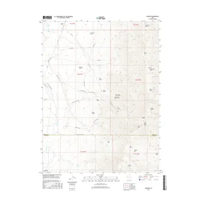
2017 Map of Goshute
USGS Topo · Published 2017About this map
Goshute occupies a high-desert valley floor at the base of the Deep Creek Range, where the landscape is defined by its series of rugged canyons and drainage systems. The settlement pattern is sparse, concentrated near the Goshute Airport and linked by specialized access routes like Eleven S Reservation Way and Bia HWY 1. The intricate canyon networks of Hardscrabble Canyon, Kelly Canyon, and Durse Canyon dominate the central terrain, leading toward the prominent heights of Bald Mtn and Rocky Peak. Water is a critical and infrequent resource here, marked by isolated points such as Skinner Springs and Rocky Spring. The infrastructure, including the Arts Ctn Mine Rd and various water-trough roads, suggests a landscape utilized for specialized transit, resource management, and remote operations within the vast Juab and Tooele County borderlands.
Find a feature on this map
60 named features on this map. Tap any name to fly to it.
Don’t see what you’re looking for? This feature index may not catch every label — zoom into the map to look around manually.
Map Details
Editions of this 2017 Goshute Map
This is the sole edition of this map. No revisions or reprints were ever made.
Other maps of this area

1908 · Fish Springs
USGS Topo · 1:250,000

1910 · Fish Springs
USGS Topo · 1:250,000

1925 · Gold Hill
USGS Topo · 1:62,500

1928 · Gold Hill
USGS Topo · 1:62,500

1953 · Tooele
USGS Topo · 1:250,000

1953 · Delta
USGS Topo · 1:250,000

1955 · Tooele
USGS Topo · 1:250,000

1955 · Elko
USGS Topo · 1:250,000

1956 · Ely
USGS Topo · 1:250,000

1958 · Elko
USGS Topo · 1:250,000