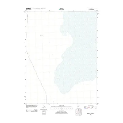
2010 Map of Goshute Wash
USGS Topo · Published 2010About this map
Goshute Wash dominates this arid landscape in Tooele County, marking a drainage pattern through the basin where seasonal waters flow. The terrain is largely defined by this expansive wash and the primary transit corridor, Callao Rd, which traverses the western portion of the quadrangle. This 2010 survey reflects the remote character of this high-desert environment, showing the minimal modern development and the persistence of traditional gravel routes that connect the few scattered ranching and mining outposts of the region. The map provides a precise record of the natural hydrology and road placement, essential for understanding the sparse settlement patterns of western Utah.
Find a feature on this map
2 named features on this map. Tap any name to fly to it.
Don’t see what you’re looking for? This feature index may not catch every label — zoom into the map to look around manually.
Map Details
Editions of this 2010 Goshute Wash Map
This is the sole edition of this map. No revisions or reprints were ever made.
Other maps of this area

1908 · Fish Springs
USGS Topo · 1:250,000

1910 · Fish Springs
USGS Topo · 1:250,000

1925 · Gold Hill
USGS Topo · 1:62,500

1928 · Gold Hill
USGS Topo · 1:62,500

1953 · Tooele
USGS Topo · 1:250,000

1953 · Delta
USGS Topo · 1:250,000

1955 · Tooele
USGS Topo · 1:250,000

1958 · Delta
USGS Topo · 1:250,000

1962 · Delta
USGS Topo · 1:250,000
1972 · Goshute Canyon
USGS Topo · 1:24,000