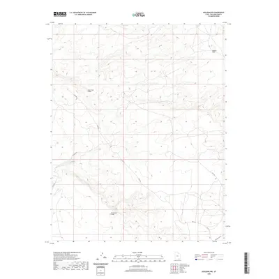
2020 Map of Goulding NW
USGS Topo · Published 2020About this map
Monument Valley defines the southern portion of this landscape, where the high desert floor is punctuated by the dramatic vertical relief of the Colorado Plateau. To the northeast, the massive uplift of Douglas Mesa overlooks a network of drainage systems and primitive routes, including Water Tank Canyon. The infrastructure here is comprised primarily of local and county roads such as Begay Rd and Train Rock Rd, which follow the natural contours of the terrain to provide access through this expansive region of San Juan County. This 2020 survey demonstrates how modern transportation like Co Rd 427 and the Douglas Cutoff interacts with the traditional geographical landmarks that have guided travelers through this part of the American Southwest for generations.
Find a feature on this map
9 named features on this map. Tap any name to fly to it.
Don’t see what you’re looking for? This feature index may not catch every label — zoom into the map to look around manually.
Map Details
Editions of this 2020 Goulding NW Map
This is the sole edition of this map. No revisions or reprints were ever made.
Other maps of this area

1886 · Henry Mountains
USGS Topo · 1:250,000

1892 · Henry Mountains
USGS Topo · 1:250,000

1952 · Clay Hills 4 SW
USGS Topo · 1:24,000

1952 · Clay Hills 3 SE
USGS Topo · 1:24,000

1952 · Clay Hills 4 SE
USGS Topo · 1:24,000

1952 · Oljeto
USGS Topo · 1:62,500
1954 · Clay Hills 3 NE
USGS Topo · 1:24,000

1954 · Clay Hills 2 SE
USGS Topo · 1:24,000
1954 · Clay Hills
USGS Topo · 1:62,500

1956 · Escalante
USGS Topo · 1:250,000