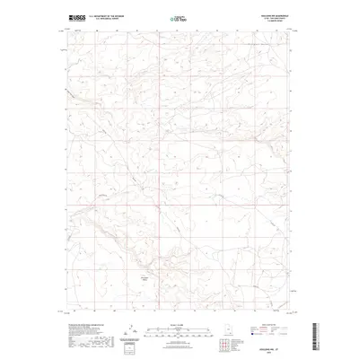
2023 Map of Goulding NW
USGS Topo · Published 2023About this map
Monument Valley dominates the southern reaches of this landscape, where the high elevation of Douglas Mesa characterizes the northeastern corner. The area is defined by a sparse network of unpaved desert routes, including Begay Rd and Train Rock Rd, which wind through the arid terrain. The drainage of Water Tank Canyon cuts through the western portion of the quadrangle, illustrating the hydrological patterns of this high-desert environment. Local transportation and access are further delineated by Co Rd 427 and the Douglas Cutoff Trl, reflecting the contemporary infrastructure within this part of San Juan County. This map provides a clear record of the relationship between significant geological formations and the remote road systems that provide access to them.
Find a feature on this map
9 named features on this map. Tap any name to fly to it.
Don’t see what you’re looking for? This feature index may not catch every label — zoom into the map to look around manually.
Map Details
Editions of this 2023 Goulding NW Map
This is the sole edition of this map. No revisions or reprints were ever made.
Other maps of this area

1886 · Henry Mountains
USGS Topo · 1:250,000

1892 · Henry Mountains
USGS Topo · 1:250,000

1952 · Clay Hills 4 SW
USGS Topo · 1:24,000

1952 · Clay Hills 3 SE
USGS Topo · 1:24,000

1952 · Clay Hills 4 SE
USGS Topo · 1:24,000

1952 · Oljeto
USGS Topo · 1:62,500
1954 · Clay Hills 3 NE
USGS Topo · 1:24,000

1954 · Clay Hills 2 SE
USGS Topo · 1:24,000
1954 · Clay Hills
USGS Topo · 1:62,500

1956 · Escalante
USGS Topo · 1:250,000