Loading...
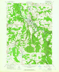
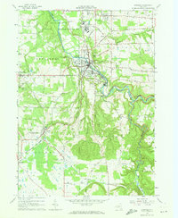
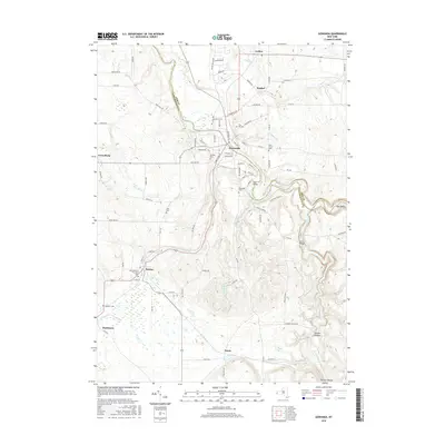
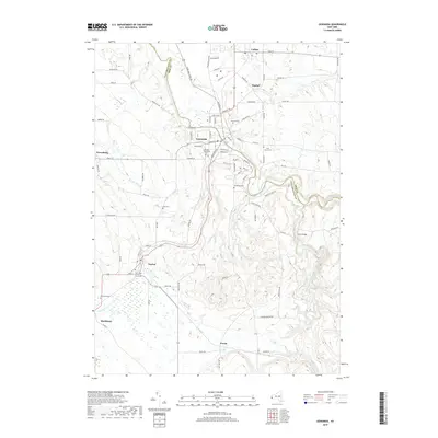
Loading map...1963 Map of Gowanda
USGS Topo · Published 1964About this map
Cattaraugus Creek carves a deep, winding path through this western New York landscape, serving as the primary boundary between Erie and Cattaraugus counties. The large complex of the Gowanda State Hospital and the northern edge of the Cattaraugus Indian Reservation dominate the northern terrain near the village of Gowanda. The area's mid-century infrastructure is defined by the Erie-Lackawanna railroad, which snakes through the valley to connect rural hubs like Dayton and Markhams.
Find a feature on this map
49 named features on this map. Tap any name to fly to it.
Don’t see what you’re looking for? This feature index may not catch every label — zoom into the map to look around manually.
Map Details
Date Portrayed1963
Date Published1964
PublisherU.S. Geological Survey
Map TypeTopographic
Scale1:24,000
Physical Dimensions22.1 x 26.9 inches
Editions of this 1963 Gowanda Map
2 editions found
Historical Maps of Collins Through Time
6 maps found

Featured Locations
Source Details
SourceU.S. Geological Survey
CopyrightPublic Domain