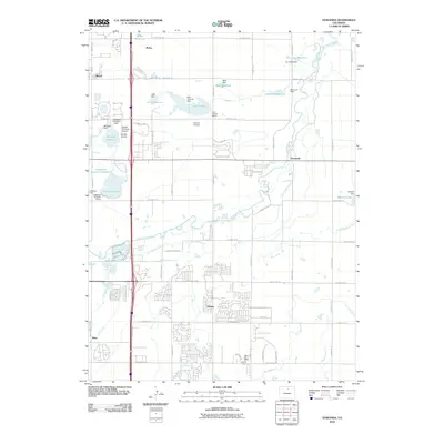
2010 Map of Gowanda
USGS Topo · Published 2010About this map
Saint Vrain Creek meanders through this portion of Weld County, defining a landscape shaped by a sophisticated network of early 21st-century irrigation infrastructure. The map documents an intricate system of water management, including the Lupton Bottom Ditch, Coal Ridge Ditch, and Last Chance Ditch, which support numerous reservoirs such as McKay Reservoir, Lake Thomas, and B L Swift Reservoir. Small settlements like Harney, Mead, and Rinn anchor the region, while the presence of the Little Ash Mine and Gentry Mine near the southern boundary points to the area's industrial history. Aviation is also prominent, with the Rancho De Aereo Airport and Frontier Airstrip located near the intersection of major transport corridors. The Pearl Howlett School remains a notable community landmark, set amidst a developing residential grid that contrasts with the traditional agricultural and mining operations.
Find a feature on this map
76 named features on this map. Tap any name to fly to it.
Don’t see what you’re looking for? This feature index may not catch every label — zoom into the map to look around manually.
Map Details
Editions of this 2010 Gowanda Map
This is the sole edition of this map. No revisions or reprints were ever made.
Other maps of this area

1902 · Greeley
USGS Topo · 1:125,000

1904 · Niwot
USGS Topo · 1:62,500

1906 · Loveland
USGS Topo · 1:62,500

1908 · Loveland
USGS Topo · 1:62,500

1949 · Gowanda
USGS Topo · 1:24,000

1949 · Fort Lupton
USGS Topo · 1:24,000

1949 · Platteville
USGS Topo · 1:24,000

1950 · Frederick
USGS Topo · 1:24,000

1950 · Gowanda
USGS Topo · 1:24,000

1950 · Platteville
USGS Topo · 1:24,000