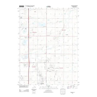
2013 Map of Gowanda
USGS Topo · Published 2013About this map
Firestone and its surrounding agricultural plains are defined by an intricate network of water management, vital for supporting growth in this part of Weld County. The landscape is characterized by numerous catchments and irrigation systems, including the Highland Ditch, Last Chance Ditch, and Lupton Bottom Ditch, which redirect water from Saint Vrain Cr to sustain local farms. The density of small reservoirs, such as McKay Reservoir, Lake Thomas, and Foster Reservoir, illustrates the critical importance of water rights and storage in Colorado's high plains economy.
Find a feature on this map
94 named features on this map. Tap any name to fly to it.
Don’t see what you’re looking for? This feature index may not catch every label — zoom into the map to look around manually.
Map Details
Editions of this 2013 Gowanda Map
This is the sole edition of this map. No revisions or reprints were ever made.
Other maps of this area

1902 · Greeley
USGS Topo · 1:125,000

1904 · Niwot
USGS Topo · 1:62,500

1906 · Loveland
USGS Topo · 1:62,500

1908 · Loveland
USGS Topo · 1:62,500

1949 · Gowanda
USGS Topo · 1:24,000

1949 · Fort Lupton
USGS Topo · 1:24,000

1949 · Platteville
USGS Topo · 1:24,000

1950 · Frederick
USGS Topo · 1:24,000

1950 · Gowanda
USGS Topo · 1:24,000

1950 · Platteville
USGS Topo · 1:24,000