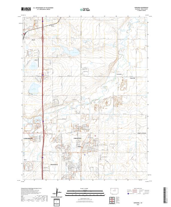
2022 Map of Gowanda
USGS Topo · Published 2022About this map
Firestone and Frederick anchor the southern portion of this landscape, showing the modern suburban footprint as it expanded north of Denver. The area is defined by an intricate network of water management, where the Saint Vrain Creek corridor is flanked by essential agricultural arteries like the Highland Ditch, Lower Boulder Ditch, and Lupton Bottom Ditch. These waterways support a dense collection of reservoirs, including Lake Marie, Bass Reservoir, and Diamond Reservoir, reflecting the long-standing reliance on irrigation in Weld County. Small communities and historical sidings like Gowanda, Mead, and Harney punctuate the grid of county roads, while the Barbour Ponds Campground indicates the transition of old gravel pits into recreational spaces. The map captures the meeting of high-plains agriculture and the growing residential corridors along Interstate 25, preserving the locations of rural features like Rancho de Aereo and the Rural Ditch.
Find a feature on this map
76 named features on this map. Tap any name to fly to it.
Don’t see what you’re looking for? This feature index may not catch every label — zoom into the map to look around manually.
Map Details
Editions of this 2022 Gowanda Map
This is the sole edition of this map. No revisions or reprints were ever made.
Other maps of this area

1902 · Greeley
USGS Topo · 1:125,000

1904 · Niwot
USGS Topo · 1:62,500

1906 · Loveland
USGS Topo · 1:62,500

1908 · Loveland
USGS Topo · 1:62,500

1949 · Gowanda
USGS Topo · 1:24,000

1949 · Fort Lupton
USGS Topo · 1:24,000

1949 · Platteville
USGS Topo · 1:24,000

1950 · Frederick
USGS Topo · 1:24,000

1950 · Gowanda
USGS Topo · 1:24,000

1950 · Platteville
USGS Topo · 1:24,000