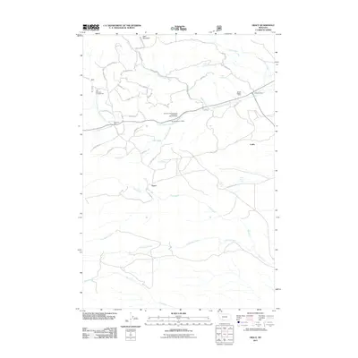
2011 Map of Grace
USGS Topo · Published 2011About this map
Grace and the nearby settlement of Nineteen Mile anchor this survey of the high mountain terrain south of Butte. The landscape is defined by a dense network of forest trails and resource extraction points, including the SE SW Section 7 Mine and the NE SW Section 14 Mine. These workings are situated among the drainages of Little Pipestone Creek and Fish Creek, which flow through a region marked by numerous named springs such as Friend Spring, Cold Spring, and Mud Spring.
Find a feature on this map
51 named features on this map. Tap any name to fly to it.
Don’t see what you’re looking for? This feature index may not catch every label — zoom into the map to look around manually.
Map Details
Editions of this 2011 Grace Map
This is the sole edition of this map. No revisions or reprints were ever made.
Other maps of this area

1893 · Dillon
USGS Topo · 1:250,000

1955 · Dillon
USGS Topo · 1:250,000

1957 · Dillon
USGS Topo · 1:250,000

1958 · Dillon
USGS Topo · 1:250,000

1960 · Twin Bridges
USGS Topo · 1:62,500

1960 · Waterloo
USGS Topo · 1:62,500

1962 · Dillon
USGS Topo · 1:250,000
1963 · Dry Mountain
USGS Topo · 1:24,000

1963 · Pipestone Pass
USGS Topo · 1:24,000

1963 · Vendome
USGS Topo · 1:24,000