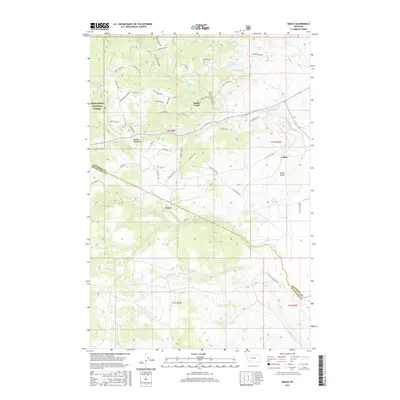
2017 Map of Grace
USGS Topo · Published 2017About this map
Deerlodge National Forest covers much of this high-elevation terrain where the Boulder Mountains meet the high desert of Montana. The settlement of Grace serves as a central point along the winding Fish Cr, while the community of Cedric is positioned near Cedar Gulch to the east. This landscape is defined by a dense network of creek drainages and springs, including Little Pipestone Cr and Mud Springs, which have long dictated the placement of mountain roads and small settlements.
Find a feature on this map
61 named features on this map. Tap any name to fly to it.
Don’t see what you’re looking for? This feature index may not catch every label — zoom into the map to look around manually.
Map Details
Editions of this 2017 Grace Map
This is the sole edition of this map. No revisions or reprints were ever made.
Other maps of this area

1893 · Dillon
USGS Topo · 1:250,000

1955 · Dillon
USGS Topo · 1:250,000

1957 · Dillon
USGS Topo · 1:250,000

1958 · Dillon
USGS Topo · 1:250,000

1960 · Twin Bridges
USGS Topo · 1:62,500

1960 · Waterloo
USGS Topo · 1:62,500

1962 · Dillon
USGS Topo · 1:250,000
1963 · Dry Mountain
USGS Topo · 1:24,000

1963 · Pipestone Pass
USGS Topo · 1:24,000

1963 · Vendome
USGS Topo · 1:24,000