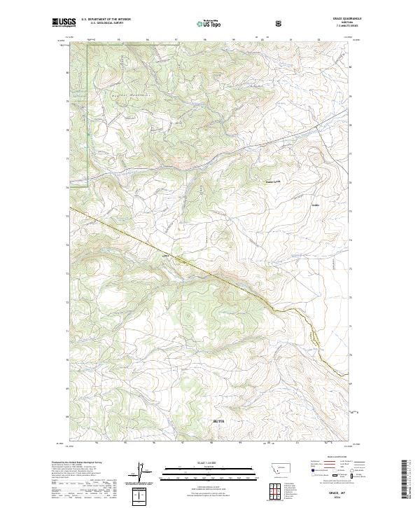
2024 Map of Grace
USGS Topo · Published 2024About this map
Grace and the nearby settlement of Cedric sit along the dividing line of Jefferson and Silver Bow Counties, where the high elevations of the Boulder Mountains meet the northern outskirts of Butte. This modern survey illustrates a landscape defined by the drainage systems of Little Pipestone Creek and Fish Creek, which carve through a network of ridges including Ranger Ridge and Sidetrack Hill.
Find a feature on this map
61 named features on this map. Tap any name to fly to it.
Don’t see what you’re looking for? This feature index may not catch every label — zoom into the map to look around manually.
Map Details
Editions of this 2024 Grace Map
This is the sole edition of this map. No revisions or reprints were ever made.
Other maps of this area

1893 · Dillon
USGS Topo · 1:250,000

1955 · Dillon
USGS Topo · 1:250,000

1957 · Dillon
USGS Topo · 1:250,000

1958 · Dillon
USGS Topo · 1:250,000

1960 · Twin Bridges
USGS Topo · 1:62,500

1960 · Waterloo
USGS Topo · 1:62,500

1962 · Dillon
USGS Topo · 1:250,000
1963 · Dry Mountain
USGS Topo · 1:24,000

1963 · Pipestone Pass
USGS Topo · 1:24,000

1963 · Vendome
USGS Topo · 1:24,000