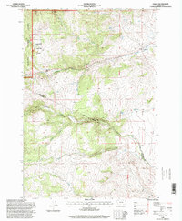
1996 Map of Grace
USGS Topo · Published 1998About this map
Deerlodge National Forest and the peaks of Tol Mountain define this landscape along the border of Jefferson and Silver Bow Counties. The settlement of Grace sits along an indefinite boundary, serving as a central point in a topography marked by several Prospect and Quarry sites. The drainage patterns are intricate, with Little Pipestone Creek and Fish Creek carving through the high country, fed by numerous water sources including Cold Spring, Friend Spring, and the aptly named Poison Spring.
Find a feature on this map
30 named features on this map. Tap any name to fly to it.
Don’t see what you’re looking for? This feature index may not catch every label — zoom into the map to look around manually.
Map Details
Editions of this 1996 Grace Map
This is the sole edition of this map. No revisions or reprints were ever made.
Other maps of this area

1893 · Dillon
USGS Topo · 1:250,000

1955 · Dillon
USGS Topo · 1:250,000

1957 · Dillon
USGS Topo · 1:250,000

1958 · Dillon
USGS Topo · 1:250,000

1960 · Twin Bridges
USGS Topo · 1:62,500

1960 · Waterloo
USGS Topo · 1:62,500

1962 · Dillon
USGS Topo · 1:250,000
1963 · Dry Mountain
USGS Topo · 1:24,000

1963 · Pipestone Pass
USGS Topo · 1:24,000

1963 · Vendome
USGS Topo · 1:24,000