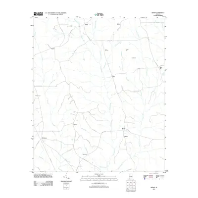
2011 Map of Grady
USGS Topo · Published 2011About this map
Patsaliga Creek and its many tributaries, including Weaver Mill Creek and Fannin Mill Creek, define the drainage patterns of this rural Alabama landscape. The area is characterized by scattered farming communities and historical family sites, such as Wiggins Farms and Grady. Local history is anchored by several family burying grounds, including Fannin Cemetery, Garner Cemetery, and Carter Cemetery, which offer valuable data points for genealogists. The road network connects small hubs like Helicon, Bradleyton, and Briar Hill, often following the natural ridges between watercourses like Dry Creek and Olustee Creek. Notable transit points such as Salter Bridge over Clayton Branch reflect the infrastructure supporting this agricultural region. The map reveals a transition from the higher ground at Collier Hill and Carter Hill down toward the creek bottoms, where the names of old routes like Smiley Ferry Rd hint at earlier river-crossing methods in the county.
Find a feature on this map
63 named features on this map. Tap any name to fly to it.
Don’t see what you’re looking for? This feature index may not catch every label — zoom into the map to look around manually.
Map Details
Editions of this 2011 Grady Map
This is the sole edition of this map. No revisions or reprints were ever made.
Other maps of this area

1953 · Montgomery
USGS Topo · 1:250,000

1953 · Andalusia
USGS Topo · 1:250,000

1956 · Montgomery
USGS Topo · 1:250,000

1957 · Montgomery
USGS Topo · 1:250,000

1957 · Andalusia
USGS Topo · 1:250,000

1957 · Letohatchee
USGS Topo · 1:62,500
1968 · Youngblood
USGS Topo · 1:24,000
1968 · Ansley
USGS Topo · 1:24,000

1968 · Petrey
USGS Topo · 1:24,000

1968 · Grady
USGS Topo · 1:24,000