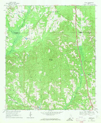
1968 Map of Ansley
USGS Topo · Published 1971About this map
The Seaboard Coast line defines the southwestern corner of this landscape, passing through the small community of Ansley and near the Ansley Sch. This rural stretch of the Alabama coastal plain is characterized by a dense network of watercourses, including Olustee Creek, McQuagge Mill Creek, and Little Patsaliga Creek, which drain the timbered and agricultural land along the border of Montgomery and Pike counties. The map captures a pattern of dispersed rural settlements, where life centered on local institutions such as the Jr High Sch at Shellhorn and the Harmony Sch further east.
Find a feature on this map
40 named features on this map. Tap any name to fly to it.
Don’t see what you’re looking for? This feature index may not catch every label — zoom into the map to look around manually.
Map Details
Editions of this 1968 Ansley Map
2 editions found
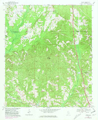
Other maps of this area

1953 · Montgomery
USGS Topo · 1:250,000

1953 · Andalusia
USGS Topo · 1:250,000

1953 · Dothan
USGS Topo · 1:250,000

1954 · Dothan
USGS Topo · 1:250,000

1955 · Dothan
USGS Topo · 1:250,000

1955 · Phenix City
USGS Topo · 1:250,000

1956 · Montgomery
USGS Topo · 1:250,000

1957 · Phenix City
USGS Topo · 1:250,000

1957 · Montgomery
USGS Topo · 1:250,000

1957 · Andalusia
USGS Topo · 1:250,000