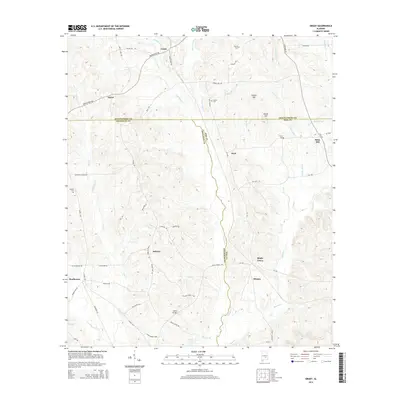
2014 Map of Grady
USGS Topo · Published 2014About this map
Bradleyton and Grady anchor the northern and western sections of this 2014 survey, where the boundaries of Montgomery, Crenshaw, and Pike counties converge. The landscape is defined by the winding course of Patsaliga Cr and Olustee Cr, with numerous smaller tributaries like Weaver Mill Cr and Fannin Mill Cr carving through the terrain. Genealogists will find significant value in the distribution of family-named landmarks and resting places, including Fannin Cem, Garner Cem, and Carter Cem. Small rural clusters such as Helicon, Shady Grove, and Olustee are connected by a network of local roads like Lapine Hwy and Meriwether Trl, illustrating the persistent agricultural and residential patterns of this Alabama interior. Notable crossings and elevations, such as Salter Bridge and Briar Hill, provide specific points of interest for those tracing property lines or historical movement across the county borders.
Find a feature on this map
66 named features on this map. Tap any name to fly to it.
Don’t see what you’re looking for? This feature index may not catch every label — zoom into the map to look around manually.
Map Details
Editions of this 2014 Grady Map
This is the sole edition of this map. No revisions or reprints were ever made.
Other maps of this area

1953 · Montgomery
USGS Topo · 1:250,000

1953 · Andalusia
USGS Topo · 1:250,000

1956 · Montgomery
USGS Topo · 1:250,000

1957 · Montgomery
USGS Topo · 1:250,000

1957 · Andalusia
USGS Topo · 1:250,000

1957 · Letohatchee
USGS Topo · 1:62,500
1968 · Youngblood
USGS Topo · 1:24,000
1968 · Ansley
USGS Topo · 1:24,000

1968 · Petrey
USGS Topo · 1:24,000

1968 · Grady
USGS Topo · 1:24,000