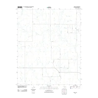
2012 Map of Grady
USGS Topo · Published 2012About this map
Grady and Atlee serve as the primary focal points of this southern Oklahoma landscape, where Jefferson County meets the surrounding plains. The area is defined by a dense network of watercourses, including the meandering paths of Mud Cr, Baker Cr, and W Mud Cr, which carve through the territory. These creeks influence the local road grid, where rural routes like E2060 Rd and N2990 Rd navigate the low-lying drainage basins. For genealogists and local historians, the presence of the Grady Cem and Atlee Cem provides specific points of interest for tracing family roots in this rural community. The map illustrates a modern settlement pattern centered on agricultural transit and local hubs, with Dennis Blvd providing a named corridor near the heart of the Grady settlement.
Find a feature on this map
24 named features on this map. Tap any name to fly to it.
Don’t see what you’re looking for? This feature index may not catch every label — zoom into the map to look around manually.
Map Details
Editions of this 2012 Grady Map
This is the sole edition of this map. No revisions or reprints were ever made.
Other maps of this area

1901 · Addington
USGS Topo · 1:125,000

1905 · Montague
USGS Topo · 1:125,000

1954 · Sherman
USGS Topo · 1:250,000

1957 · Ardmore
USGS Topo · 1:250,000

1958 · Sherman
USGS Topo · 1:250,000

1962 · Ryan
USGS Topo · 1:62,500

1963 · Ardmore
USGS Topo · 1:250,000
1968 · Spanish Fort
USGS Topo · 1:24,000

1968 · Fleetwood
USGS Topo · 1:24,000
1968 · Prairie Valley School
USGS Topo · 1:24,000