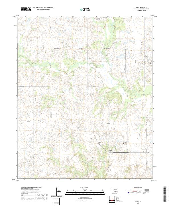
2022 Map of Grady
USGS Topo · Published 2022About this map
Grady and Atlee anchor the southern Jefferson County landscape, serving as the primary settlements in this rural corner of Oklahoma. The terrain is defined by a dense network of seasonal and perennial waterways, including Mud Cr and its tributary W Mud Cr, which meander through the central townships. Local heritage is preserved at Grady Cem and Atlee Cem, providing vital reference points for genealogists tracing family roots in this region. The section-line road grid, featuring routes like Grady Park Blvd and James Ewbank Blvd, reflects the orderly agricultural layout of the land. Further north, the 067006 Reservoir stands as a notable water feature, while smaller drainages like Baker Cr and Post Oak Cr drain the surrounding prairie and pasture land.
Find a feature on this map
40 named features on this map. Tap any name to fly to it.
Don’t see what you’re looking for? This feature index may not catch every label — zoom into the map to look around manually.
Map Details
Editions of this 2022 Grady Map
This is the sole edition of this map. No revisions or reprints were ever made.
Other maps of this area

1901 · Addington
USGS Topo · 1:125,000

1905 · Montague
USGS Topo · 1:125,000

1954 · Sherman
USGS Topo · 1:250,000

1957 · Ardmore
USGS Topo · 1:250,000

1958 · Sherman
USGS Topo · 1:250,000

1962 · Ryan
USGS Topo · 1:62,500

1963 · Ardmore
USGS Topo · 1:250,000
1968 · Spanish Fort
USGS Topo · 1:24,000

1968 · Fleetwood
USGS Topo · 1:24,000
1968 · Prairie Valley School
USGS Topo · 1:24,000