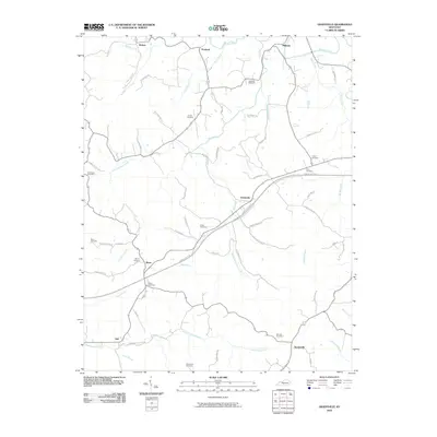
2010 Map of Gradyville
USGS Topo · Published 2010About this map
Gradyville and its surrounding rural hamlets are defined by a network of creeks and branches that cut through the Adair County landscape. At the intersection of the Cumberland Pkwy and Big Creek, the settlement of Gradyville serves as a central point for a region dotted with numerous family cemeteries, including Tarters Cemetery, Dohoney Cemetery, and Stapp Cemetery. These burial grounds, often located along backroads like Rollin Kemp Rd or Carter Keltner Rd, provide significant data for genealogical research.
Find a feature on this map
69 named features on this map. Tap any name to fly to it.
Don’t see what you’re looking for? This feature index may not catch every label — zoom into the map to look around manually.
Map Details
Editions of this 2010 Gradyville Map
This is the sole edition of this map. No revisions or reprints were ever made.
Other maps of this area

1953 · Gradyville
USGS Topo · 1:24,000

1953 · Breeding
USGS Topo · 1:24,000

1953 · Edmonton
USGS Topo · 1:24,000

1953 · Amandaville
USGS Topo · 1:24,000

1953 · Exie
USGS Topo · 1:24,000

1953 · Gresham
USGS Topo · 1:24,000

1953 · East Fork
USGS Topo · 1:24,000

1953 · Cane Valley
USGS Topo · 1:24,000

1954 · Columbia
USGS Topo · 1:24,000

1956 · Corbin
USGS Topo · 1:250,000