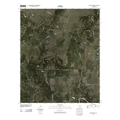
2010 Map of Graford West
USGS Topo · Published 2010About this map
The Brazos River carves a winding path through the southern reach of this landscape, defining the prominent river curves at Fortune Bend and B C Harris Bend. In this portion of Palo Pinto County, the terrain transitions from the elevated height of McClure Mountain down to the open expanse of Rocky Prairie. The small community of Graford serves as the primary settlement, situated at the junction of several local routes like Division St and Ragle Rd. The local economy and history are marked by the presence of the Loyd-Dalton Oil Field and the quiet grounds of the Lu Queen Cemetery, which offer valuable points of reference for genealogists and local historians. A dense network of seasonal drainages, including Little Keechi Creek and Dark Valley Creek, illustrates the complex watershed that feeds into the river system below Scott Canyon.
Find a feature on this map
27 named features on this map. Tap any name to fly to it.
Don’t see what you’re looking for? This feature index may not catch every label — zoom into the map to look around manually.
Map Details
Editions of this 2010 Graford West Map
This is the sole edition of this map. No revisions or reprints were ever made.
Other maps of this area

1891 · Palo Pinto
USGS Topo · 1:125,000

1918 · Palo Pinto
USGS Topo · 1:125,000

1924 · Palo Pinto 2-b
USGS Topo · 1:48,000

1924 · Palo Pinto 2-a
USGS Topo · 1:48,000

1924 · Palo Pinto 1-b
USGS Topo · 1:48,000

1924 · Palo Pinto 2-c
USGS Topo · 1:48,000

1927 · Pickwick
USGS Topo · 1:62,500

1927 · Mineral Wells
USGS Topo · 1:62,500

1954 · Abilene
USGS Topo · 1:250,000

1954 · Wichita Falls
USGS Topo · 1:250,000