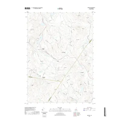
2018 Map of Grafton
USGS Topo · Published 2018About this map
The Smith River winds through the central valley of this New Hampshire landscape, connecting the clustered settlements of Grafton, Grafton Center, and East Grafton. This terrain is defined by a dense network of high peaks and ridges, including Isinglass Mtn, Barber Mtn, and Smith Mtn, which frame the residential and agricultural corridors. Local history is anchored by sites like the Prescott Hill Cem and the small communities at Robinson Corner and Fords Mill.
Find a feature on this map
105 named features on this map. Tap any name to fly to it.
Don’t see what you’re looking for? This feature index may not catch every label — zoom into the map to look around manually.
Map Details
Editions of this 2018 Grafton Map
This is the sole edition of this map. No revisions or reprints were ever made.
Other maps of this area

1902 · Sunapee
USGS Topo · 1:62,500

1905 · Sunapee
USGS Topo · 1:62,500

1907 · Sunapee
USGS Topo · 1:62,500

1927 · Cardigan
USGS Topo · 1:62,500

1927 · Mascoma
USGS Topo · 1:62,500

1928 · Mount Kearsarge
USGS Topo · 1:62,500

1930 · Cardigan
USGS Topo · 1:62,500

1931 · Mount Kearsarge
USGS Topo · 1:62,500

1932 · Mascoma
USGS Topo · 1:62,500

1949 · Portland
USGS Topo · 1:250,000