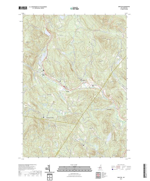
2024 Map of Grafton
USGS Topo · Published 2024About this map
Grafton and its surrounding hamlets of Grafton Center and East Grafton sit within a landscape defined by sharp elevation changes and the legacy of the regional railroad economy. The corridor of the Northern Rail Trl follows the natural path of the Smith River, tracing the route where industry once flourished at sites like Fords Mill. The map is particularly rich for genealogical research, identifying numerous small family or community burial grounds including the Prescott Hill Cem, Litchfield Cem, and the North Road Cem. High points such as Isinglass Mtn and Mount Pleasant loom over the valley floors, where water bodies like Kilton Pond and Three Thousand Acre Pond remain prominent landmarks. The settlement pattern at Robinson Corner and along the Mascoma Valley Rd reflects the enduring rural character of this New Hampshire upland.
Find a feature on this map
111 named features on this map. Tap any name to fly to it.
Don’t see what you’re looking for? This feature index may not catch every label — zoom into the map to look around manually.
Map Details
Editions of this 2024 Grafton Map
This is the sole edition of this map. No revisions or reprints were ever made.
Other maps of this area

1902 · Sunapee
USGS Topo · 1:62,500

1905 · Sunapee
USGS Topo · 1:62,500

1907 · Sunapee
USGS Topo · 1:62,500

1927 · Cardigan
USGS Topo · 1:62,500

1927 · Mascoma
USGS Topo · 1:62,500

1928 · Mount Kearsarge
USGS Topo · 1:62,500

1930 · Cardigan
USGS Topo · 1:62,500

1931 · Mount Kearsarge
USGS Topo · 1:62,500

1932 · Mascoma
USGS Topo · 1:62,500

1949 · Portland
USGS Topo · 1:250,000