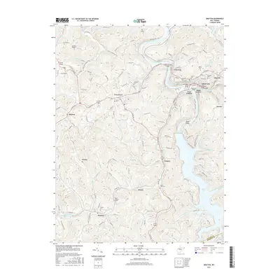
2016 Map of Grafton
USGS Topo · Published 2016About this map
Grafton and its surrounding communities are positioned along the winding Tygart Valley River, a landscape defined by significant elevation changes and deep creek valleys. This 2016 survey shows the urban cluster of South Grafton, West Grafton, and Fetterman, connected by the John F. Bennett Bridge and the Southside Bridge. The presence of numerous burial grounds, including Bluemont Cem and Mount Calvary Cem, offers significant detail for those tracking family history in the area.
Find a feature on this map
64 named features on this map. Tap any name to fly to it.
Don’t see what you’re looking for? This feature index may not catch every label — zoom into the map to look around manually.
Map Details
Editions of this 2016 Grafton Map
This is the sole edition of this map. No revisions or reprints were ever made.
Other maps of this area

1886 · St. George
USGS Topo · 1:125,000

1891 · St. George
USGS Topo · 1:125,000

1902 · Fairmont
USGS Topo · 1:62,500

1904 · Philippi
USGS Topo · 1:62,500

1907 · Thornton
USGS Topo · 1:62,500

1907 · Belington
USGS Topo · 1:62,500

1923 · Fairmont
USGS Topo · 1:62,500

1925 · Philippi
USGS Topo · 1:62,500

1926 · Fairmont
USGS Topo · 1:62,500

1926 · Thornton
USGS Topo · 1:62,500