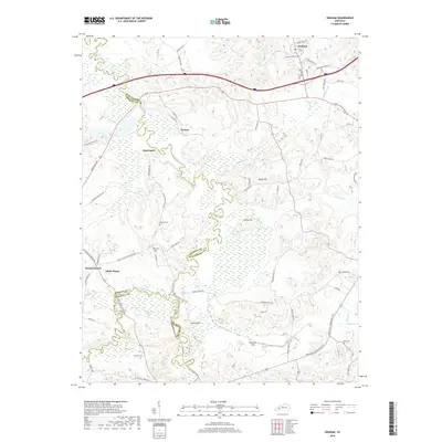
2019 Map of Graham
USGS Topo · Published 2019About this map
The Pond River and its meandering tributaries, including West Fork Pond River and Elk Pond Cr, define the drainage and swampy lowlands where Hopkins, Muhlenberg, and Christian counties meet. In this 2019 survey, the landscape is a mix of small agricultural settlements like White Plains and McNary alongside rising terrain such as Atkinson Hills and Turkey Hill. Genealogists will find several family and community burial grounds well-documented, including Oglesby Cem, Sharbers Cem, and Liberty Cem. The infrastructure follows the winding hydrology, with roads like Jestro Ford Rd and Mount Carmel-Pond River Rd connecting isolated farmsteads and the historic communities of Graham and Bakersport. The map illustrates the persistent rural character of this Western Kentucky tri-county border area, where traditional land use continues around the edges of prominent hills and river bottoms.
Find a feature on this map
68 named features on this map. Tap any name to fly to it.
Don’t see what you’re looking for? This feature index may not catch every label — zoom into the map to look around manually.
Map Details
Editions of this 2019 Graham Map
This is the sole edition of this map. No revisions or reprints were ever made.
Other maps of this area

1909 · Madisonville
USGS Topo · 1:62,500

1909 · Central City
USGS Topo · 1:62,500

1911 · Drakesboro
USGS Topo · 1:48,000

1912 · Nortonville
USGS Topo · 1:62,500

1913 · Drakesboro
USGS Topo · 1:62,500

1952 · Greenville
USGS Topo · 1:24,000

1952 · Crofton
USGS Topo · 1:24,000

1953 · Haleys Mill
USGS Topo · 1:24,000

1953 · Nortonville
USGS Topo · 1:24,000

1953 · Madisonville East
USGS Topo · 1:24,000