
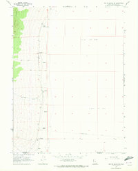
1971 Map of Graham Peak
USGS Topo · Published 1974About this map
The Silver Island Mts dominate this 1971 topographical survey, rising sharply from the surrounding Alkali or Mud flats and expansive Sand Dunes. This arid landscape is defined by its series of high summits, including Graham Peak, Campbell Peak, and Jenkins Peak, which are separated by a complex network of steep drainages such as Donner Canyon and Lost Canyon. Traces of human activity are sparse but notable, with several instances of Ruins, a Corral, and a Prospect indicating scattered efforts at ranching or prospecting in this remote environment. The presence of numerous Caves and several Mines suggest the geological interest of the range, while a series of Jeep Trails and Pack Trails provide the only established routes through the rugged canyons and across the desert floor near the Box Elder and Tooele county line.
Find a feature on this map
24 named features on this map. Tap any name to fly to it.
Don’t see what you’re looking for? This feature index may not catch every label — zoom into the map to look around manually.
Map Details
Editions of this 1971 Graham Peak Map
This is the sole edition of this map. No revisions or reprints were ever made.
Other maps of this area

1953 · Tooele
USGS Topo · 1:250,000

1954 · Brigham City
USGS Topo · 1:250,000

1955 · Tooele
USGS Topo · 1:250,000

1958 · Brigham City
USGS Topo · 1:250,000

1962 · Brigham City
USGS Topo · 1:250,000
1967 · Crater Island SW
USGS Topo · 1:24,000

1970 · Crater Island
USGS Topo · 1:24,000

1971 · Silver Island Pass
USGS Topo · 1:24,000

1971 · Tetzlaff Peak
USGS Topo · 1:24,000

1971 · Bonneville Racetrack
USGS Topo · 1:24,000