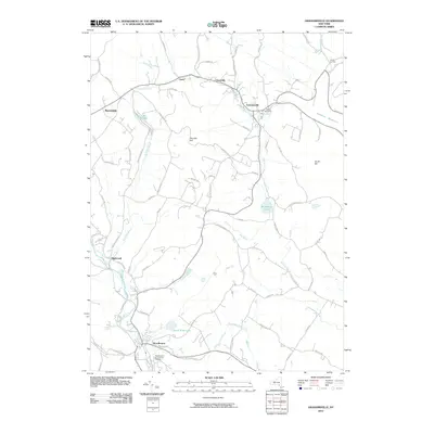
2010 Map of Grahamsville
USGS Topo · Published 2010About this map
Grahamsville and Woodbourne anchor this Sullivan County landscape, where the southern Catskills terrain is defined by the sharp descent of the Neversink River and the eastern reach of the Rondout Reservoir. The settlement pattern follows the valley floors, with hamlets like Neversink, Curry, and Unionville connected by roads such as Claryville Rd and Bonnel Rd. Higher elevations are marked by landmarks like Thunder Hill and South Hill, while the southern reaches feature the complex of the Woodbourne Correctional Institute.
Find a feature on this map
73 named features on this map. Tap any name to fly to it.
Don’t see what you’re looking for? This feature index may not catch every label — zoom into the map to look around manually.
Map Details
Editions of this 2010 Grahamsville Map
This is the sole edition of this map. No revisions or reprints were ever made.
Other maps of this area

1903 · Slide Mountain
USGS Topo · 1:62,500

1904 · Ellenville
USGS Topo · 1:62,500

1905 · Slide Mountain
USGS Topo · 1:62,500

1906 · Ellenville
USGS Topo · 1:62,500

1909 · Monticello
USGS Topo · 1:62,500

1910 · Neversink
USGS Topo · 1:62,500

1911 · Monticello
USGS Topo · 1:62,500

1942 · Neversink
USGS Topo · 1:62,500

1942 · Lackawack
USGS Topo · 1:24,000
1942 · Ellenville
USGS Topo · 1:24,000