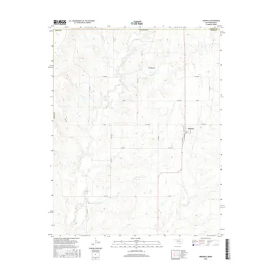
2016 Map of Grainola
USGS Topo · Published 2016About this map
Grainola and the small settlement of Frankfort anchor this northern Oklahoma landscape just below the Kansas border in the mid-2010s. The area is defined by a dense network of country roads and several drainages that feed the local watershed, including Otter Cr and Salt Cr. In the village of Grainola, the street grid is clearly defined by Broadway, Choctaw Ave, and Creek Ave. The terrain transitions from the high ground of the Osage County plains into numerous small creek valleys, where watercourses like Lone Tree Cr and Bayliss Cr have carved the landscape. This era shows the modern configuration of the county road system, such as Co RD 4900 and Co RD 4700, which provide the primary infrastructure for this ranching and agricultural region.
Find a feature on this map
35 named features on this map. Tap any name to fly to it.
Don’t see what you’re looking for? This feature index may not catch every label — zoom into the map to look around manually.
Map Details
Editions of this 2016 Grainola Map
This is the sole edition of this map. No revisions or reprints were ever made.
Other maps of this area

1889 · Burden
USGS Topo · 1:125,000

1916 · Foraker
USGS Topo · 1:62,500

1935 · Kaw
USGS Topo · 1:62,500

1955 · Wichita
USGS Topo · 1:250,000

1955 · Enid
USGS Topo · 1:250,000

1958 · Enid
USGS Topo · 1:250,000

1958 · Wichita
USGS Topo · 1:250,000
1962 · Cedar Vale West
USGS Topo · 1:24,000

1962 · Dexter SW
USGS Topo · 1:24,000

1964 · Kaw City
USGS Topo · 1:24,000