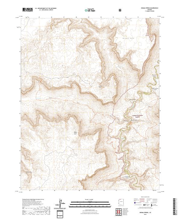
2021 Map of Grama Spring
USGS Topo · Published 2021About this map
Kaibab National Forest dominates the southeastern quadrant of this terrain, where steep canyon walls and isolated points define the drainage of Kanab Cr. The landscape is a network of named natural features and historical trails used for access through the Arizona backcountry. Vital water sources like Grama Spring and Willow Spring are documented near the high plateau points of Bulrush Point and Sunshine Point. The mapping reveals a complex system of drainage ways, including Grama Canyon, Big Cove Canyon, and Dinner Pockets Canyon, which feed into the central creek system. For those interested in navigation and recreation, several named routes are traced across the contours, such as the Hack Canyon Trl, Lawson Canyon Trl, and Ranger Trl, providing a clear view of the established pathways through this part of Mohave and Coconino counties.
Find a feature on this map
22 named features on this map. Tap any name to fly to it.
Don’t see what you’re looking for? This feature index may not catch every label — zoom into the map to look around manually.
Map Details
Editions of this 2021 Grama Spring Map
This is the sole edition of this map. No revisions or reprints were ever made.
Other maps of this area

1886 · Kaibab
USGS Topo · 1:250,000

1953 · Grand Canyon
USGS Topo · 1:250,000

1954 · Heaton Knolls SE
USGS Topo · 1:24,000

1954 · Heaton Knolls
USGS Topo · 1:62,500

1957 · Grand Canyon
USGS Topo · 1:250,000

1957 · Jumpup Canyon
USGS Topo · 1:62,500

1958 · Grand Canyon
USGS Topo · 1:250,000

1960 · Grand Canyon
USGS Topo · 1:250,000

1962 · Kanab Point
USGS Topo · 1:62,500

1962 · Tuckup Canyon
USGS Topo · 1:62,500