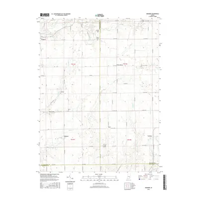
2016 Map of Grammer
USGS Topo · Published 2016About this map
Grammer and Sardinia anchor this rural landscape where the borders of Bartholomew, Decatur, and Jennings counties converge. The terrain is defined by a dense network of watercourses including Clifty Creek in the northwest and Poplar Root Cr in the southeast, reflecting a traditional Indiana agricultural layout. Small settlements like Burnsville and Alert are connected by a grid of county roads, punctuated by several legacy burial grounds such as Little Sand Creek Cem and Parkison Cem that offer significant value for genealogical research.
Find a feature on this map
84 named features on this map. Tap any name to fly to it.
Don’t see what you’re looking for? This feature index may not catch every label — zoom into the map to look around manually.
Map Details
Editions of this 2016 Grammer Map
This is the sole edition of this map. No revisions or reprints were ever made.
Other maps of this area

1942 · Columbus
USGS Topo · 1:125,000

1947 · Hope
USGS Topo · 1:24,000

1948 · Hope
USGS Topo · 1:24,000

1950 · Edinburg
USGS Topo · 1:62,500

1953 · Cincinnati
USGS Topo · 1:250,000

1957 · Cincinnati
USGS Topo · 1:250,000

1957 · Butlerville
USGS Topo · 1:24,000

1957 · Azalia
USGS Topo · 1:24,000

1957 · North Vernon
USGS Topo · 1:24,000

1958 · Westport
USGS Topo · 1:24,000