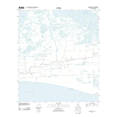
2012 Map of Grand Bayou
USGS Topo · Published 2012About this map
Front Ridge and Mesquite Ridge provide the essential high ground for settlement in this coastal Cameron Parish landscape, where the land meets the Gulf of Mexico. The area is defined by a intricate network of waterways, including the Creole Canal and the various branches of Grand Bayou, such as the N Prong of Grand Bayou and E Prong of Grand Bayou. These natural levees and ridges support a density of local family roads and infrastructure alongside the North Creole Gas Field and West Creole Gas Field, reflecting the region's dual reliance on the coastal environment and the energy industry. Genealogists will find several burial sites noted along the ridges, including First Baptist Cem, La Bove Cem, and Duhon Cem. The proximity to Calcasieu Lake and Lambert Lake underscores the marshy, amphibious character of this South Louisiana territory.
Find a feature on this map
49 named features on this map. Tap any name to fly to it.
Don’t see what you’re looking for? This feature index may not catch every label — zoom into the map to look around manually.
Map Details
Editions of this 2012 Grand Bayou Map
This is the sole edition of this map. No revisions or reprints were ever made.
Other maps of this area

1934 · Cameron
USGS Topo · 1:24,000

1934 · Sweet Lake
USGS Topo · 1:24,000

1934 · Grand Bayou
USGS Topo · 1:24,000

1934 · Boudreaux Lake
USGS Topo · 1:24,000

1935 · Cameron
USGS Topo · 1:31,680

1935 · Sweet Lake
USGS Topo · 1:31,680

1935 · Hackberry
USGS Topo · 1:31,680

1935 · Boudreaux Lake
USGS Topo · 1:31,680

1935 · Grand Bayou
USGS Topo · 1:31,680

1935 · Bay Labauve
USGS Topo · 1:31,680