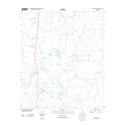
2013 Map of Grand Bluff
USGS Topo · Published 2013About this map
The Sabine River snakes through the heart of Panola County, defining the landscape around the community of Grand Bluff. This region of East Texas is characterized by its complex network of oxbow lakes and sloughs, including Black Lake, Akins Lake, and Little Jernigan Lake, which sit alongside distinctive river features like Black Shoals and Watt Shoals. The presence of the Carthage Gas Field and several "Camp" sites like Kelly Camp points to the area's dual character of natural riparian habitat and industrial resource extraction. Local history is anchored by names such as Grand Bluff Cem and Crossroads Cem, while old road designations like Piney Grove School Rd and Sunny Grove Church Rd hint at the locations of former community centers. Further north, the settlement of Horton sits near the headwaters of Caddo Cr, surrounded by family-named landmarks like Massey Ponds and Shoemaker Bluff.
Find a feature on this map
82 named features on this map. Tap any name to fly to it.
Don’t see what you’re looking for? This feature index may not catch every label — zoom into the map to look around manually.
Map Details
Editions of this 2013 Grand Bluff Map
This is the sole edition of this map. No revisions or reprints were ever made.
Other maps of this area
1943 · Waskom
USGS Topo · 1:62,500
1945 · Waskom
USGS Topo · 1:62,500
1945 · Socagee Bayou
USGS Topo · 1:62,500

1956 · Tyler
USGS Topo · 1:250,000
1956 · Deadwood
USGS Topo · 1:62,500
1958 · Darco
USGS Topo · 1:62,500
1958 · Carthage
USGS Topo · 1:62,500
1962 · Stricklin Springs
USGS Topo · 1:24,000
1962 · De Berry
USGS Topo · 1:24,000
1983 · Grand Bluff
USGS Topo · 1:24,000