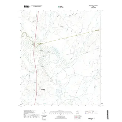
2019 Map of Grand Bluff
USGS Topo · Published 2019About this map
The Sabine River snakes across this landscape, defining the boundary between Harrison and Panola counties. This river-dominated environment is marked by intricate water systems including Greer Slough, Caney Slough, and Water Gap Slough, reflecting a topography shaped by seasonal shifts and overflow. Small rural communities and family landmarks are scattered throughout the lowlands and bluffs, most notably at Grand Bluff. The map records several localized burial grounds such as Grand Bluff Cem and Crossroads Cem, providing specific points of interest for genealogical research. Unique river features like Baker Fish Hole, Watt Shoals, and Shoemaker Bluff highlight the historic importance of the river for local navigation and subsistence, while the network of county roads and farm-to-market routes like FM 1794 connects these disparate riverside settlements.
Find a feature on this map
73 named features on this map. Tap any name to fly to it.
Don’t see what you’re looking for? This feature index may not catch every label — zoom into the map to look around manually.
Map Details
Editions of this 2019 Grand Bluff Map
This is the sole edition of this map. No revisions or reprints were ever made.
Other maps of this area

1943 · Waskom
USGS Topo · 1:62,500

1945 · Waskom
USGS Topo · 1:62,500

1945 · Socagee Bayou
USGS Topo · 1:62,500

1956 · Tyler
USGS Topo · 1:250,000

1956 · Deadwood
USGS Topo · 1:62,500

1958 · Darco
USGS Topo · 1:62,500

1958 · Carthage
USGS Topo · 1:62,500

1962 · Stricklin Springs
USGS Topo · 1:24,000

1962 · De Berry
USGS Topo · 1:24,000

1983 · Grand Bluff
USGS Topo · 1:24,000