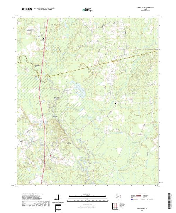
2022 Map of Grand Bluff
USGS Topo · Published 2022About this map
The Sabine River carves a winding path through this region on the border of Harrison and Panola Counties, creating a complex landscape of oxbow lakes and bottomlands. Landmarks such as Shoemaker Bluff and West Camp Bend overlook a riverbed punctuated by named crossings and hazards like Watt Shoals and Black Shoals. This area is defined by its numerous water features, including the sprawling Caney Slough and isolated pools like Baker Fish Hole and Wattle Duck Pond, reflecting a terrain shaped by the river's seasonal shifts.
Find a feature on this map
76 named features on this map. Tap any name to fly to it.
Don’t see what you’re looking for? This feature index may not catch every label — zoom into the map to look around manually.
Map Details
Editions of this 2022 Grand Bluff Map
This is the sole edition of this map. No revisions or reprints were ever made.
Other maps of this area

1943 · Waskom
USGS Topo · 1:62,500

1945 · Waskom
USGS Topo · 1:62,500

1945 · Socagee Bayou
USGS Topo · 1:62,500

1956 · Tyler
USGS Topo · 1:250,000

1956 · Deadwood
USGS Topo · 1:62,500

1958 · Darco
USGS Topo · 1:62,500

1958 · Carthage
USGS Topo · 1:62,500

1962 · Stricklin Springs
USGS Topo · 1:24,000

1962 · De Berry
USGS Topo · 1:24,000

1983 · Grand Bluff
USGS Topo · 1:24,000