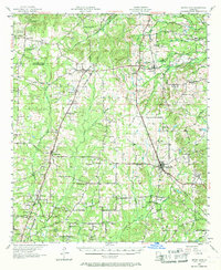
1957 Map of Grand Cane
USGS Topo · Published 1968About this map
Roseneath Plantation and Park Dota Plantation stand as significant landholdings in this pocket of Northwest Louisiana, where the border of Caddo Parish and De Soto Parish cuts through a landscape defined by meandering waterways like Keatchie Bayou and Castor Bayou. The map captures a transition in rural education and social infrastructure, noting the Longstreet Rosenwald School and several abandoned facilities such as the Joseph Grove Sch and Little Rock Sch.
Find a feature on this map
70 named features on this map. Tap any name to fly to it.
Don’t see what you’re looking for? This feature index may not catch every label — zoom into the map to look around manually.
Map Details
Editions of this 1957 Grand Cane Map
2 editions found
Other maps of this area

1941 · Pelican
USGS Topo · 1:62,500

1943 · Waskom
USGS Topo · 1:62,500

1943 · Pleasant Hill
USGS Topo · 1:62,500

1944 · Logansport
USGS Topo · 1:62,500

1944 · Pleasant Hill
USGS Topo · 1:62,500

1945 · Grand Cane
USGS Topo · 1:62,500

1945 · Waskom
USGS Topo · 1:62,500

1945 · Greenwood
USGS Topo · 1:62,500

1945 · Socagee Bayou
USGS Topo · 1:62,500

1945 · Mansfield
USGS Topo · 1:62,500