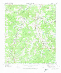
1972 Map of Grand Cane
USGS Topo · Published 1974About this map
Grand Cane and its surrounding parishes are defined by a complex network of bayous and the mid-century expansion of the petroleum industry. The landscape is dotted with numerous small rural congregations and cemeteries, such as Spanish Bethel Ch and Fullalove Cem, reflecting the deep-rooted local genealogy of the region. Significant landholdings like Beauna Vista Plantation and Roseneath Plantation persist alongside newer infrastructure, including the De Soto Parish Airfield and the Grand Cane Lookout Tower.
Find a feature on this map
77 named features on this map. Tap any name to fly to it.
Don’t see what you’re looking for? This feature index may not catch every label — zoom into the map to look around manually.
Map Details
Editions of this 1972 Grand Cane Map
This is the sole edition of this map. No revisions or reprints were ever made.
Other maps of this area

1941 · Pelican
USGS Topo · 1:62,500

1943 · Waskom
USGS Topo · 1:62,500

1943 · Pleasant Hill
USGS Topo · 1:62,500

1944 · Logansport
USGS Topo · 1:62,500

1944 · Pleasant Hill
USGS Topo · 1:62,500

1945 · Grand Cane
USGS Topo · 1:62,500

1945 · Waskom
USGS Topo · 1:62,500

1945 · Greenwood
USGS Topo · 1:62,500

1945 · Socagee Bayou
USGS Topo · 1:62,500

1945 · Mansfield
USGS Topo · 1:62,500