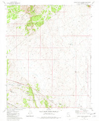
1981 Map of Grand Canyon Caverns
USGS Topo · Published 1981About this map
Grand Canyon Caverns and the vast Aubrey Valley dominate this landscape during the early 1980s. The map illustrates a high-desert environment where water management is critical, evidenced by a network of catchments like Last Chance Tank and Blue Mtn Tank scattered across the terrain. Human activity is clustered around the Grand Canyon Caverns Airport and the small settlements of Hyde Park and Deer Lodge, which sit near the prominent ridge of Blue Mountain.
Find a feature on this map
22 named features on this map. Tap any name to fly to it.
Don’t see what you’re looking for? This feature index may not catch every label — zoom into the map to look around manually.
Map Details
Editions of this 1981 Grand Canyon Caverns Map
This is the sole edition of this map. No revisions or reprints were ever made.
Other maps of this area

1886 · Diamond Creek
USGS Topo · 1:250,000

1892 · Diamond Creek
USGS Topo · 1:250,000

1948 · Williams
USGS Topo · 1:250,000

1954 · Williams
USGS Topo · 1:250,000

1956 · Williams
USGS Topo · 1:250,000

1960 · Williams
USGS Topo · 1:250,000

1961 · Williams
USGS Topo · 1:250,000
1967 · Peach Springs NE
USGS Topo · 1:24,000
1967 · Nelson
USGS Topo · 1:24,000
1980 · Robbers Roost Canyon
USGS Topo · 1:24,000