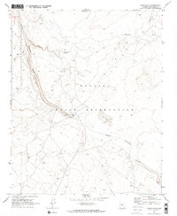
1969 Map of Grand Falls
USGS Topo · Published 1972About this map
Grand Falls serves as the focal point of this arid landscape within the Navajo Indian Reservation. The Little Colorado River winds through the terrain, its course marked by various topographical transitions including nearby Sand Dunes and the seasonal flows of Dinnebito Wash. The presence of a Gaging Station and a designated Picnic Area near the falls suggests its role as a point of hydrologic study and local interest during the late 1960s.
Find a feature on this map
11 named features on this map. Tap any name to fly to it.
Don’t see what you’re looking for? This feature index may not catch every label — zoom into the map to look around manually.
Map Details
Editions of this 1969 Grand Falls Map
2 editions found
Other maps of this area

1886 · San Francisco Mtns
USGS Topo · 1:250,000

1891 · San Francisco Mtns
USGS Topo · 1:250,000

1894 · San Francisco Mtns
USGS Topo · 1:250,000

1899 · San Francisco Mtns
USGS Topo · 1:250,000

1947 · Flagstaff
USGS Topo · 1:250,000

1954 · Flagstaff
USGS Topo · 1:250,000

1955 · Grand Falls NE
USGS Topo · 1:24,000

1955 · Black Falls 4 SW
USGS Topo · 1:24,000
1955 · Black Falls 4 SE
USGS Topo · 1:24,000

1958 · Flagstaff
USGS Topo · 1:250,000