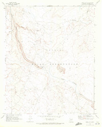
1969 Map of Grand Falls
USGS Topo · Published 1972About this map
Navajo Indian Reservation lands dominate this late-1960s landscape, centered on the dramatic geological break where the Little Colorado River plunges at Grand Falls. The river's course is flanked by several archaeological sites marked simply as Ruins, hinting at much older habitation patterns along the canyon rims. Infrastructure in this era remains minimal, focused primarily on water management and basic access, including a Gaging Station and a Picnic Area near the falls. The terrain north of the river is defined by drainage systems like Dinnebito Wash and prominent Sand Dunes to the southeast of the main cataract. A network of Jeep Trails provides the only passage through this arid environment, connecting isolated points such as Muddy Tank and the cinder-cone landscape around Little Roden.
Find a feature on this map
11 named features on this map. Tap any name to fly to it.
Don’t see what you’re looking for? This feature index may not catch every label — zoom into the map to look around manually.
Map Details
Editions of this 1969 Grand Falls Map
2 editions found
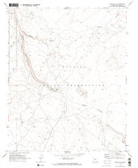
Other maps of this area

1886 · San Francisco Mtns
USGS Topo · 1:250,000

1891 · San Francisco Mtns
USGS Topo · 1:250,000

1894 · San Francisco Mtns
USGS Topo · 1:250,000

1899 · San Francisco Mtns
USGS Topo · 1:250,000

1947 · Flagstaff
USGS Topo · 1:250,000

1954 · Flagstaff
USGS Topo · 1:250,000

1955 · Grand Falls NE
USGS Topo · 1:24,000

1955 · Black Falls 4 SW
USGS Topo · 1:24,000
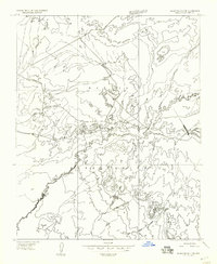
1955 · Black Falls 4 SE
USGS Topo · 1:24,000

1958 · Flagstaff
USGS Topo · 1:250,000